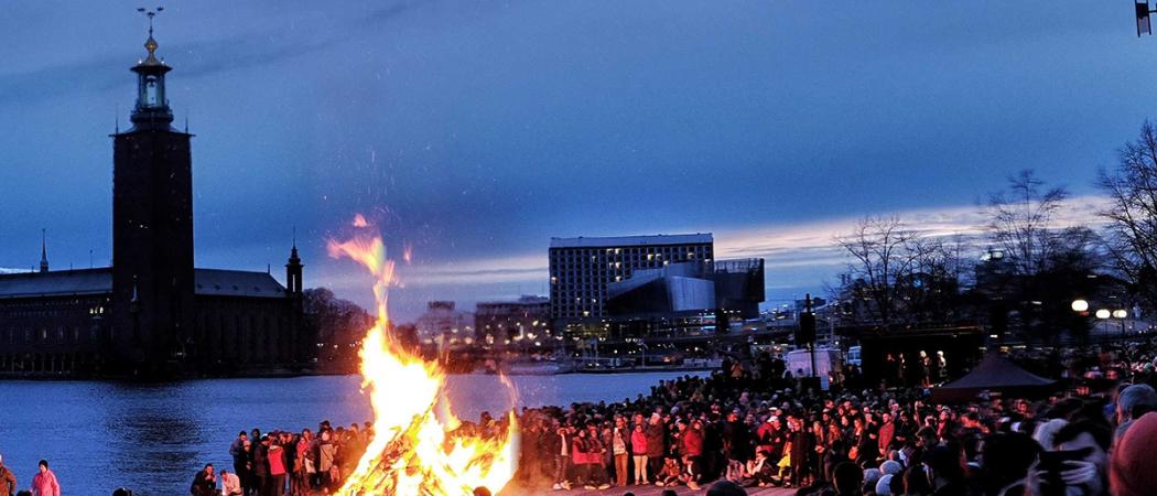
Valborg celebrations coincide with a high risk of forest fires through much of Sweden, including the Stockholm area. Photo: Pablo Collantes
Weeks of drought and sporadic forest and grass fires have threatened to put a damper on traditional Walpurgis Night celebrations tonight in Sweden, where communities typically light bonfires to mark the final night of April. Meanwhile, any outbreaks can be monitored in real time at KTH using a system that recently helped emergency responders in Mozambique during the devastating floods in March.
Swedish authorities are warning that there is a high risk of forest and grass fires this week and some communities, such as Upplands Bro (northwest of Stockholm), have taken the step of banning the traditional bonfires that neighborhoods organize to celebrate Walpurgis Night (or Valborg).
Outbreaks of forest fires in recent weeks in Sweden have been monitored with a system developed by Professor Yifang Ban and colleagues in the Department of Geoinformatics at KTH.
Using satellite data and machine learning methods, Ban is applying a monitoring method for monitoring natural disasters in near real-time. In this way, the Swedish Civil Contingencies Agency (MSB), as well as firefighting units, can quickly get an overview of forest and grass fires in progress. And it can help monitoring the progression of a fire.
The same method has been applied to help monitor the deadly flooding in Mozambique.
The KTH researchers have developed their own methods that use both a short wave infrared (SWIR) index and a radar-based framework in order to effectively monitor forest fires. SWIR can “see” through smoke and is an effective way to detect active fires and the damage. However, SWIR data is affected by clouds. They also need radar that is capable of penetrating through clouds, smoke and imaging both day and night.
“With really good resolution - down to 10 meters - we can get updates of the status every two to three days. This is not as frequent as we wish, which can be remedied by lower resolution with data from VIIRS (375 meters) or MODIS (1,000 meters),” she says.
Ban says that today they use free data, which has limitations.
“If the MSB belonged to the organizations International Charter Space and Major Disasters and Global Monitoring for Environment and Security (GMES), this would provide access to high-resolution data daily in order to detect new fires, monitor existing ones and obtain information on the damage that occurred.”
With the upcoming launches of the Canadian RADARSAT constellations in 2019, and the radar CubeSat constellations by ICEYE and Capella Space, radar images will be available at daily and hourly intervals, she say. “When these data become available, real-time forest fire monitoring will be possible using our methods.”
KTH researchers at the Department of Geoinformatics have collected data on recent fires in Sweden, which has been provided to MSB, which Ban reports has been appreciative for the information.
Incidentally, within the framework of a digitalisation initiative at KTH, Ban and her collaborators at KTH have just been granted a grant to work on research on forest fire monitoring.
This release was first published 30 April 2019 by KTH.


 Receive the Funding Newswire [full access requires a subscription] each Tuesday, our Policy Bulletin each Thursday, and news about bridging Europe’s east-west innovation gap twice a month in The Widening.
 A unique international forum for public research organisations and companies to connect their external engagement with strategic interests around their R&D system.